Post by Admin on Nov 18, 2020 1:47:50 GMT
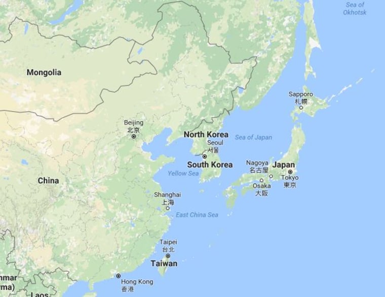
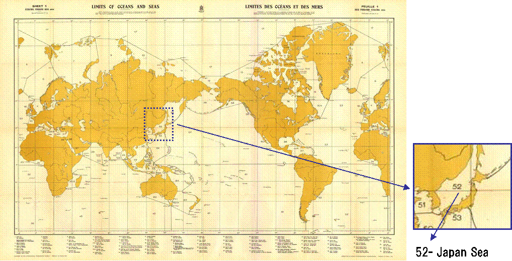
The International Hydrographic Organization’s decision to continue using Japan Sea designation as the only name for the body of sea between Japan, South Korea, North Korea and Russia has been welcomed by the government as recognition of its longstanding position.
A new policy of creating digital charts with numbers used to designate sea areas is expected to have a limited impact on the debate over the naming.
“We won the part that we should have won,” a senior Foreign Ministry official said Monday, referring to the expression in the proposal by the IHO’s secretary-general, which was adopted by the IHO’s online general assembly on Tuesday morning, Japan standard time.
The International Hydrographic Organization, which sets guidelines for global nautical maps, has tentatively approved a proposal to allow continued use of the name "Sea of Japan." The body also approved a proposal to use numbers to identify global sea areas.
North and South Korea have protested the use of "Sea of Japan," saying it stems from the country's colonization. They're asking for a revision to global guidelines that countries use when drawing up nautical maps. They want the name changed to "East Sea," or have both names used concurrently.
Japan's government maintains that "Sea of Japan" is the only internationally established name and that there is no need or basis for changing it.
Japanese government officials say the proposal to allow continued use of the name was tentatively approved during the IHO's online general assembly meeting that began on Monday.
The member nations also approved a proposal to adopt new guidelines to use numbers instead of specific names to identify sea areas, and to manage data for digital charts.
The two proposals are expected to be formally decided this month after member states confirm records of the meeting.
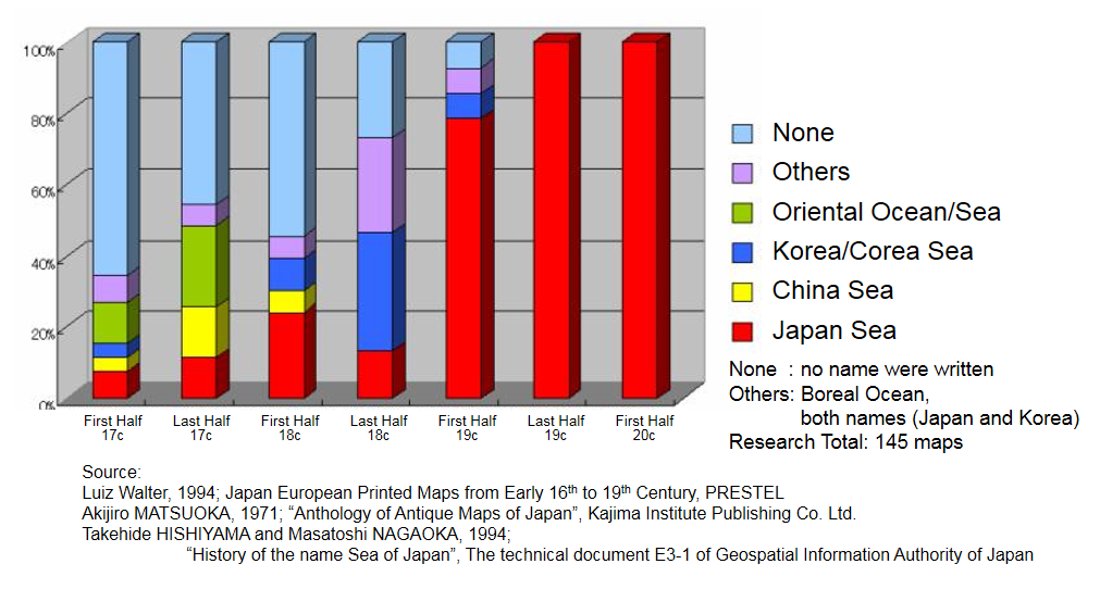
Since 1992, when South Korea began insisting that the name “East Sea” be written along with the Sea of Japan, the government has consistently argued that the Sea of Japan is the only internationally established name for the body of water, based on IHO guidelines and studies of historical maps from around the world.
However, South Korea has in recent years lobbied North Korea and other countries and strengthened cooperation between the government and the private sector in an effort to establish its case, moves that rang alarm bells in Japan.
“The fact that ‘East Sea’ does not appear [in the proposal of the secretary general] at all is the result of Japan’s efforts,” a Foreign Ministry executive said, expressing the government’s relief at the decision.
The creation of a digital version of the chart, which shows sea areas in a numerical format, was a planned compromise by the IHO that took into account South Korean public opinion to a certain extent, and the government’s position is that it was unavoidable.
The digital version is expected to be provided to organizations involved in shipping operations, and the data will be stored in computers and other devices for use. It can contain more information than paper charts and, when combined with other data, can display information such as the location of users’ ships and other vessels, and marine weather information.
A government official said that the digital version would not directly affect Japan Sea naming issue because it does not include the names of any sea areas.
However, there is no guarantee that South Korea will ease its insistence on its claim. A senior government official said, “We have no choice but to continue to take various opportunities in the future to promote the legitimacy of the designation of Japan Sea.”